SciFire Alerts Version 2.0: Scaling Predictive Protection in the Western Ghats
In our previous update, From Satellites to Soil, we outlined the foundation of the Akole Fire Watch. Our initial goal was bringing visibility to forest fires in the Western Ghats by connecting satellite data with community reporting. Building that first iteration taught us a great deal about the realities on the ground. It also highlighted a clear limitation. Simply mapping a fire after it has started is passive. True conservation and protection require anticipation.
At Scigram, our core mission is advancing humanity through deep science and technology. Operating without financial backing requires us to focus strictly on building tools that serve a direct, practical purpose. Today, we are evolving our foundation, transitioning the platform from a passive observation tool into a proactive intelligence engine. Reflecting this broader scope and scale, the project is now officially named SciFire Alerts. We have completely rebuilt our architecture, moving from a passive mapping dashboard to a highly personalized early-warning ecosystem. Here is a look under the hood at the new technology driving this evolution.
Geographic Expansion and Deep Mapping
Our initial version was limited to the Akole region. However, a recent request from an alumnus of the Palsunde Ashram School highlighted an urgent need further north. In response, we have expanded our monitoring grid to encompass the Palghar region, specifically covering the vulnerable terrains of Jawhar, Mokhada, and Vikramgad.
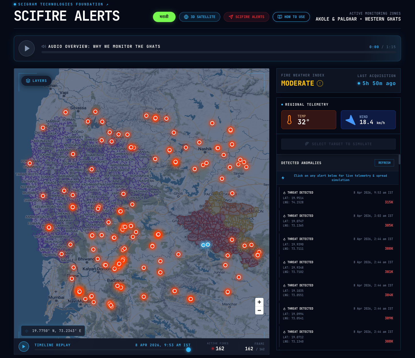
To make this expansion actionable for local stakeholders, we deeply mapped the geography. Version 2.0 integrates precise village boundaries and demarcated forest regions. Crucially, we mapped the spread of Lantana camara, an invasive weed known to dangerously accelerate forest fires. We also incorporated Eco-Sensitive Regions (ESR) into the visual grid. This multilayered approach allows forest authorities and government officials to prioritize their conservation efforts based on specific ecological vulnerabilities rather than raw satellite data alone.
Predicting Spread: The Rothermel Model
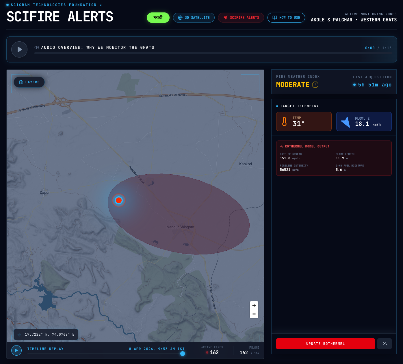
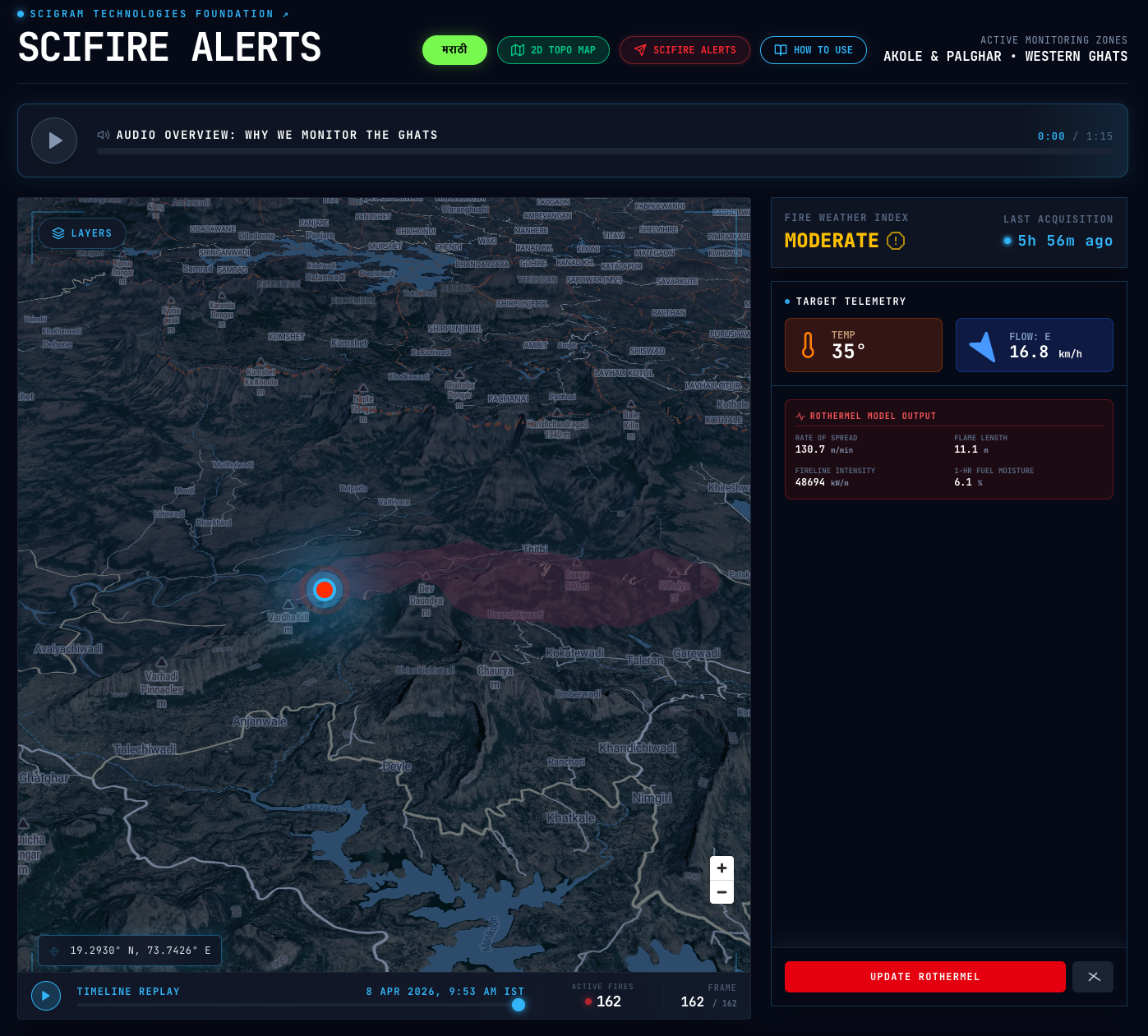
Knowing a fire exists is only half the battle; knowing where it will spread is the true challenge. We have integrated a live Rothermel Fire Spread Simulation directly into the dashboard. By combining live weather telemetry (wind speed and humidity) with the topographical data of the Western Ghats, the system calculates the predicted Rate of Spread (ROS). Users can view this in a rich 3D environment or a minimal 2D mode designed for low-bandwidth connections.
Here is an interactive simulation demonstrating the physics of the Rothermel model. You can adjust the wind and terrain parameters to observe how they mathematically alter the fire's trajectory
Hyper-Local Protection: Telegram Geofencing
We recognized that farmers working in the fields don't have time to constantly refresh a web dashboard. We needed to bring the alerts directly to them. Locals can now mark their farm's location using our integrated Telegram bot at @scifirealerts.
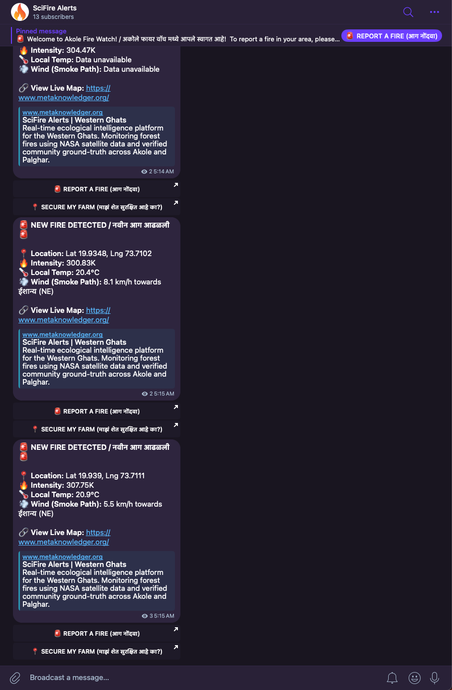
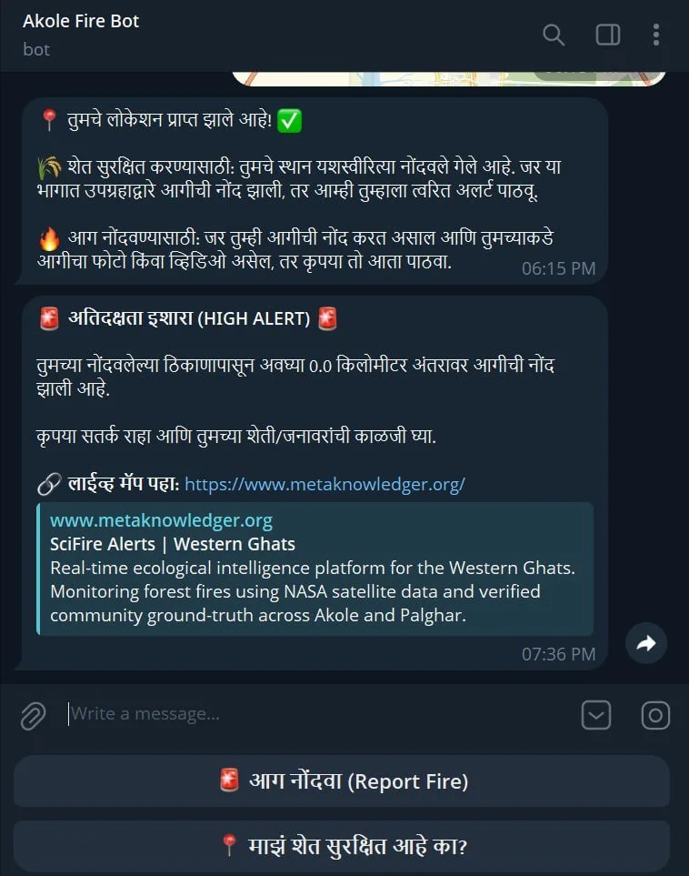
By clicking a single "Secure My Farm" (माझं शेत सुरक्षित आहे का?) button, locals register their coordinates. Behind the scenes, our automated Python engine uses the Haversine formula, calculating the great-circle distance between two points on a sphere, to monitor their exact location. If a NASA satellite detects a thermal anomaly within 10 kilometers of their registered pin, the system calculates the wind vectors and instantly dispatches a localized, high-alert direct message.
You can explore the geometry of the Haversine distance tracking in the interactive demonstration here.
Understanding the Human Cost: GDELT and the Media Pain Index
Fires are not just ecological events; they are socio-economic crises. To capture the human impact, we integrated the GDELT Project (Global Database of Events, Language, and Tone). Our system continuously scrapes regional news coverage, extracting live themes and sentiment.
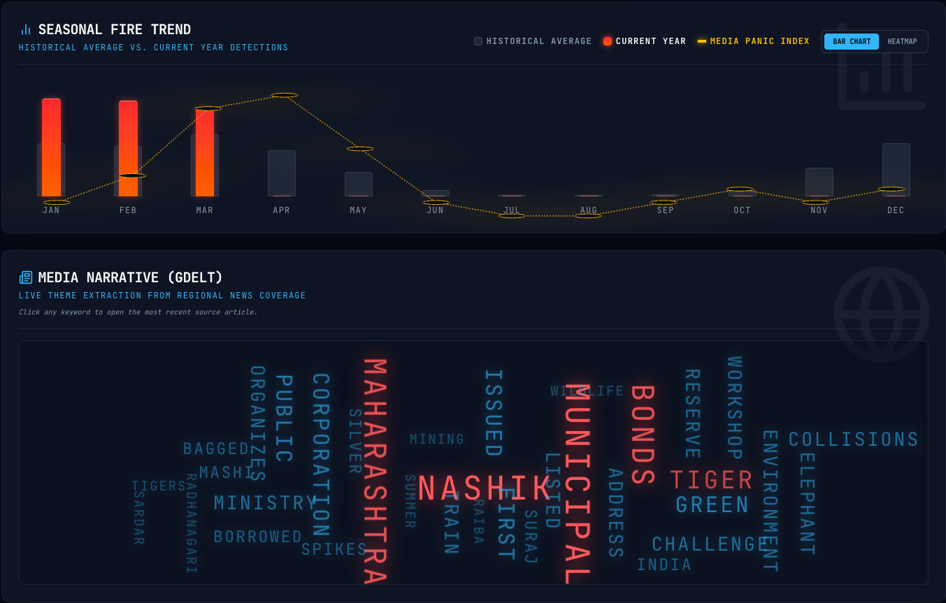
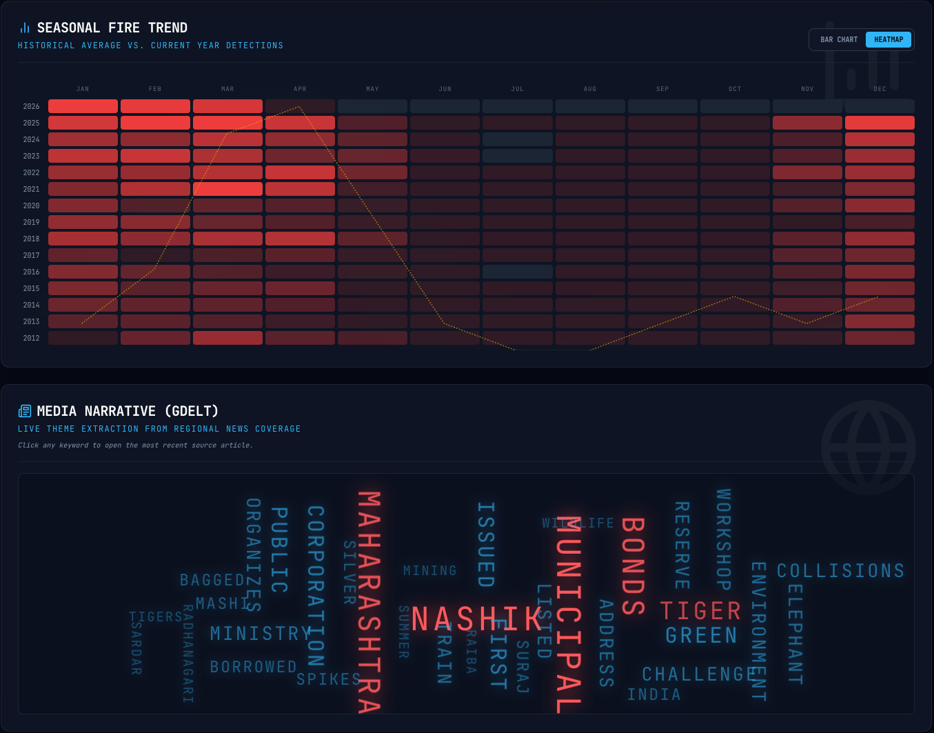
We synthesize this data into our custom Media Pain Index, visualized through heat maps and bar charts on the dashboard. This allows policymakers and researchers to see not just the physical footprint of the fire, but the severity of its impact on local communities as reported in real-time media.
Accessibility: Bridging the Language Gap
Technology only works if the community can use it. The entire SciFire Alerts platform is now fully bilingual, offering seamless toggling between English and Marathi. Furthermore, we have integrated crisp audio explainers in both languages, breaking down complex data into understandable insights for users with varying levels of digital literacy.
Actionable Routing: Navigate to Fire
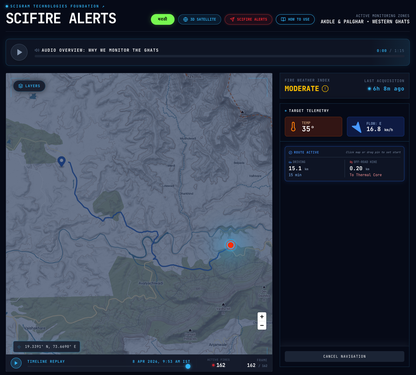
Raw data must eventually translate into immediate action. For forest department officials and local first responders, we developed a direct navigation feature. With a single interaction, stakeholders can generate the most efficient route from their location to an active fire point. This feature closes the loop between satellite detection and ground response.
Resilient Architecture: The API Waterfall
Rural applications must be resilient. In Version 2.0, we migrated to a modern Next.js environment powered by serverless functions.
A major technical upgrade is our "API Waterfall." Weather data is critical for our spread simulations. If our primary weather provider experiences an outage, our backend instantly and silently falls back to a secondary, secure API provider (Tomorrow.io). This ensures our predictive models never go offline during an emergency.
SciFire Alerts is built to be a resilient, actionable tool through the sheer dedication of a small team committed to scientific rigor and public safety. By combining global satellite intelligence with hyper-local data, we are providing a scalable model for grassroots climate resilience.